Press Release - New Resilience Strategy Helps Protect One of City’s Most Dynamic Waterfront Ecosystems
Together with the community, the City developed 70+ strategies to protect the Islais Creek area from inland floods and rising seas through 2080—while improving local mobility, economy, and environment.
San Francisco, CA — Today, the City delivered the Islais Creek Southeast Mobility and Adaptation Strategy (ICSMAS) to the California Department of Transportation (Caltrans). As San Francisco pursues ambitious greenhouse gas emissions reductions to help minimize the severity of the climate crisis, it’s adapting and protecting the city and its people from the unavoidable impacts of an already heated planet. ICSMAS focuses on sea level rise and flood protection.
“We’re excited to provide the public and City decision makers a comprehensive set of inter-connected tools and actions that can be deployed in the near-term to protect our shoreline communities, at-risk assets, and natural systems,” said Rich Hillis, Planning Director.
As an historic Bay wetland, the lower-lying Islais Creek district is already vulnerable to stormwater and coastal flooding today. By 2080, the climate crisis is projected to cause upwards of 52” of permanent sea level rise inundation and an additional 41” of flooding during coastal storms. Together, water levels around the shoreline could be eight feet higher than today. Without urgent action, there could be significant land lost around the creek forever and temporary coastal flooding could create severe disruptions of transportation, economic, and ecological systems inland. The Islais Creek area is an important commercial hub, hosting some of the city’s last remaining industrial and maritime cargo uses and the associated skilled, middle-wage job opportunities that help sustain a diverse local employment base. The City’s main sewage treatment plant, key transit operations facilities, and multimodal corridors sit in this unique watershed and must be protected within a functional tidal ecosystem.
“Islais Creek is home to critical Muni facilities and infrastructure that provide transportation to the entire city,” said Jeffrey Tumlin, SFMTA Director of Transportation. “We’re partnering with our sister agencies to address vulnerabilities associated with a changing climate to protect San Francisco’s transportation service and reliability.”
Importantly, the larger district is home to diverse residential neighborhoods, including the Bayview and its African American Arts and Cultural District. These often-vulnerable areas have long suffered environmental injustices like pollution, limited parks and food access, and health disparities—and already face disproportionate climate change burdens. During the project, hundreds of community stakeholders joined workshops and online conversations to provide their insights and to identify important neighborhood amenities and services. This input underpins the ICSMAS strategies and helps ensure they advance equity.
“I want to thank our City departments and members of the community for participating in this important work to plan for the future of San Francisco,” said Mayor London Breed. “We know that climate change will have a significant impact on our city—especially our most vulnerable communities. The strategies developed in this project will help San Francisco lead the fight against climate change and become a more resilient and sustainable city.”
By gaining a complete understanding of future flood risks, assets at stake, and the community’s goals for addressing them, ICSMAS provides a comprehensive set of flood adaptation strategies that protect the area through 2080 while supporting other needed improvements and maximizing community benefits in the nearer term.
“The Islais Creek Southeast Mobility Adaptation Strategy has greatly enhanced the Port’s understanding of flood risk in the southeast waterfront,” said Elaine Forbes, Executive Director of the Port of San Francisco. “The Port is proud to have been a partner in this effort which was built on community engagement. ICSMAS will support the Port’s ongoing resilience work in the southern waterfront through the Waterfront Resilience Program.”
Background. ICSMAS is one of the City’s deliverables identified in its 2020 Hazards and Climate Resilience Plan, which set the framework for addressing all threats, like earthquakes, extreme heat, wildfire smoke, and flooding, and more with a robust set of strategies.
Led by San Francisco Planning with SFMTA, the Port, SF Public Utilities Commission, and consultant lead AECOM, the ICSMAS Team sought a robust and collaborative process from the outset. In concert with community members, elected officials, and agency commissions, it developed flood protection solutions that also enhance transportation, jobs, nature, and equity. At the outset, technical experts helped developed the City’s first combined flood mapping analysis to understand the confluence of rainfall-based stormwater flooding, coastal storm flooding, plus sea level rise—and ensure the ICSMAS strategies were sufficient. The Team also coordinated efforts with the Port’s broader Waterfront Resilience Program (WRP), which includes flood and seismic mitigation along the 7.5 miles of Bay shoreline it manages from Fisherman’s Wharf to Heron’s Head Park. Together, the teams co-hosted several in-person community workshops (pre-COVID) with residents, workers, property owners, local organizations, and service providers to establish five community goals to guide all flood adaptation planning in the Islais Creek area:
- Transportation: A transportation system that is resilient and adaptable to flood risk.
- Environment: A healthy environment for residents, workers, visitors and ecologies.
- Economy: A sustainable economy that benefits local residents, workers, and industries.
- Community and Social Equity: A socially and environmentally resilient neighborhood.
- Governance: Authentic and transparent public engagement during and beyond planning.
Building on technical analysis and community inputs, comprehensive adaptation scenarios were first explored at the district scale to ensure strategies and investments maximize community benefits. Detailed strategies were then developed for eight at-risk City assets, including piers, bridges, and transit facilities. To the extent feasible, nature-based and living shoreline adaptation strategies were prioritized to deliver flood protection along with parks and habitat areas to support biodiversity. Flood adaptation strategies also seek to enhance mobility through expanded active transportation and transit facilities, additional traveler safety, and improved connections between maritime and industrial uses and regional highway and rail systems.
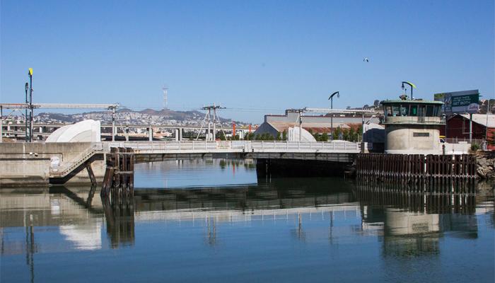
For ease of implementation, the strategies are grouped together into “adaptation pathways” within five sub-geographic “Reaches”: Northeastern Waterfront (Pier 80), Creek Channel Crossing (Islais Creek and Illinois Street bridges), Northwestern Creek Bank (SFMTA bus facilities), Southwestern Creek Bank (Islais Creek Park), and Southeastern Waterfront (Piers 90 through 96 and the Backlands). The Adaptation Pathway approach provides optimal and flexible sequences of manageable and linked strategies, which anticipate key inputs (e.g. funding, science, market forces) and include future decision points that help manage risk under uncertain future conditions. It allows decision-makers to examine a set of potential actions within the context of current realities and future scenarios at multiple time scales—and make lower-risk investments in the nearer term.
To confirm the proposals and conclude ICSMAS, the City hosted two virtual Community Circle-Back events and attended community and public commission meetings to share the draft strategies and hear feedback. Now complete, ICMSAS will serve as a key input to the range of flood adaptation alternatives and strategies being explored by the WRP’s Adapt Plan and United States Army Corp of Engineers (USACE) Flood Study. They include near-and long-term actions, costs, and funding for addressing earthquake, coastal flooding, and sea level rise risks. Working with the community and City departments, the USACE will identify a preferred Federal Plan and the Port can identify a Locally Preferred Plan. The goal is to recommend a final net-benefit plan for a federally funded flood risk reduction project to Congress by 2025.
ICSMAS strategies will also be pursued and implemented through further interagency and other partnerships, community conversations, additional analysis, grant applications, capital funding, and other mechanisms outlined in the project’s Implementation and Funding Report. Potential nearer-term projects may include shoreline protection and amenity improvements at Warm Water Cove and Islais Creek Park, enhancements and additions to the Blue Greenway, green infrastructure around key MUNI facilities, and shoreline adaptation measures at Heron’s Head Park. Additional information and updates may be found on San Francisco Planning’s Islais Creek webpage and the Port’s Waterfront Resilience Program site.
###