Central SoMa Plan
Project Status: Completed
The Central SoMa Plan is expected to deliver nearly 16 million square feet for new housing and jobs, over $2B in public benefits, including: 33 percent affordable housing, $500M for transit, substantial improvements to open space, streets, and environmental sustainability, and funding for cultural preservation and community services.
On May 10, 2018 the Planning Commission unanimously adopted the Central SoMa Plan and issued the following:
- Motion 20182 certifying the Final Environmental Impact Report
- Resolution 20183 containing the CEQA Findings
- Resolution 20184 approving the General Plan Amendments, including the Central SoMa Plan
- Resolution 20185 recommending adoption with modifications of the Planning Code and Administrative Code
- Resolution 20186 approving the Zoning Map Amendments
- Resolution 20187 recommending adoption of the Implementation Program
- Resolution 20188 recommending adoption of the Housing Sustainability District
On December 4, 2018, the Central SoMa Plan was unanimously adopted by the Board of Supervisors.
Find a summary of the amendments introduced by the Board of Supervisors here.
- Board File No. 180490: General Plan Amendments
- Board File No. 180184: Planning Code & Administrative Code Amendments
- Board File No. 180185: Zoning Map Amendments
- Board File No. 180453: Housing Sustainability District
- Board File No. 180612: Special Tax Financing Law
- Board File No. 180622: Resolution of Intent to Establish the Central SoMa Special Tax District
- Board File No. 180623: Resolution of Intent to Incur Bonded Indebtedness in an Amount not to Exceed $5.3 billion
Download the complete Central SoMa Plan & Implementation Strategy as adopted in December 2018. The Plan includes final objectives and policies, plus supporting maps and graphics.The Implementation Strategy includes (A) Implementation Matrix, (B) Public Benefits Package, (C) Guide to Urban Design, (D) Key Development Site Guidelines, and (E) Key Streets Guidance.
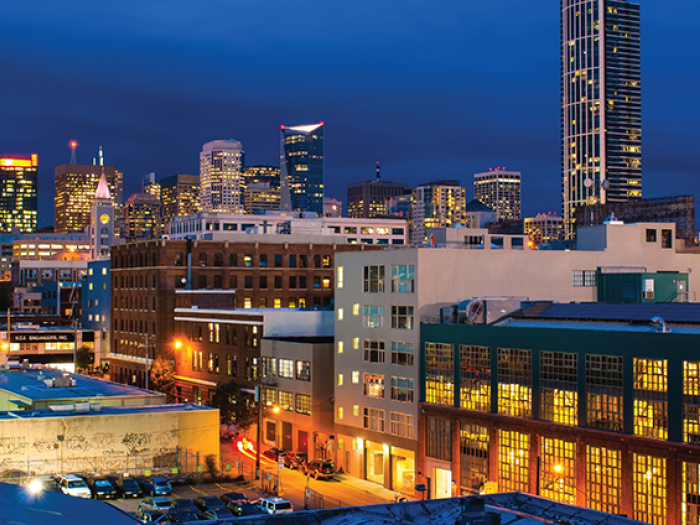
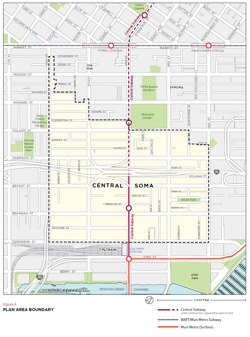
The Central SoMa Plan Area consists of the rectangle bounded by Market Street, Townsend Street, 2nd Street, and 6th Street.
On October 23, 2018, the Board of Supervisors unanimously approved the designation of the following Article 10 and 11 historic landmarks and conservation districts.
Central SoMa Article 10 Individual Landmark and Landmark District Designations
- 180720 - Planning Code - Landmark Designation - 228-248 Townsend Street (aka New Pullman Hotel)
- 180721 - Planning Code - Landmark Designation - 457 Bryant Street (aka Piledrivers, Bridge, and Structural Ironworkers Local No. 77 Union Hall)
- 180722 - Planning Code - Landmark Designation - 500-504-4th Street (aka Hotel Utah)
- 180723 - Planning Code - Clyde and Crooks Warehouse Historic District
Central SoMa Article 11 Designations
- 180724 - Planning Code - Mint-Mission Conservation District
- 180725 - Planning Code - Designation of Various Properties as Significant and Contributory in the C-3 District Based on Architectural, Historic and Aesthetic Value
- 180726 - Planning Code - Amending Kearny-Market-Mason-Sutter Conservation District and Article 11 Designation of 55-5th Street
The Central SoMa Plan is the result of seven years of intensive public engagement. Find information from our public hearings, meetings, and other public outreach and engagement strategies here.
The Central SoMa Draft Environmental Impact Report (EIR) was released in December 2016 and the Response to Comments was released in March 2018. These two documents form the Final EIR, available here.
On September 25, 2018, the San Francisco Board of Supervisors unanimously rejected all appeals to the Central SoMa EIR and upheld the certification.
For general questions about the Central SoMa area plan:
Lisa Chen
lisa.chen@sfgov.org
415.575.9124
For questions about active development projects in Central SoMa:
Richard Sucré
richard.sucre@sfgov.org
415.575.9108